Approximate Location Map
Large Map »
Latitude: 55.9028 / 55°54'10"N
Longitude: -3.06 / 3°3'36"W
OS Eastings: 333820
OS Northings: 668251
OS Grid: NT338682
Mapcode National: GBR 7025.9V
Mapcode Global: WH6SV.ZW0Q
Plus Code: 9C7RWW3Q+4X
Entry Name: Laundry Bridge, Dalkeith House
Listing Name: Dalkeith Park, Laundry Bridge
Listing Date: 22 January 1971
Category: B
Source: Historic Scotland
Source ID: 332032
Historic Scotland Designation Reference: LB1438
Building Class: Cultural
ID on this website: 200332032
Location: Dalkeith
County: Midlothian
Electoral Ward: Dalkeith
Parish: Dalkeith
Traditional County: Midlothian
Tagged with: Bridge
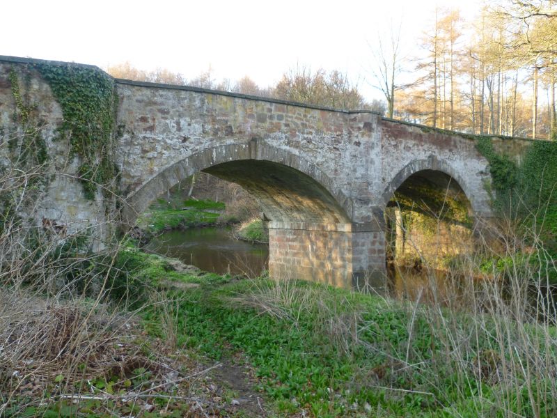
18th century. Vehicle bridge, on N-S axis. Double span with segmental arches. Red sandstone rubble. Ashlar piers, voussoirs and slab coping. Abutments advanced to W and E. Canted refuge over cutwater to W and E. Corbels at springing of arches to W. Gibbsian keystones. Band course to piers.
Laundry Bridge crosses River South Esk. A Group - see DALKEITH PARK.
External links are from the relevant listing authority and, where applicable, Wikidata. Wikidata IDs may be related buildings as well as this specific building. If you want to add or update a link, you will need to do so by editing the Wikidata entry.


Other nearby listed buildings
