Approximate Location Map
Large Map »
Latitude: 57.4991 / 57°29'56"N
Longitude: -3.9573 / 3°57'26"W
OS Eastings: 282801
OS Northings: 847117
OS Grid: NH828471
Mapcode National: GBR J8LX.41K
Mapcode Global: WH4GF.5SV0
Plus Code: 9C9RF2XV+J3
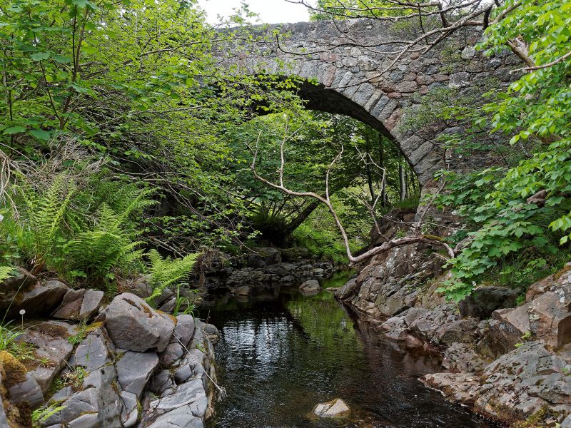
Entry Name: Barevan Bridge, Wester Barevan
Listing Name: Bareven Bridge over the Allt Dearg, Wester Bareven
Listing Date: 6 September 1979
Category: C
Source: Historic Scotland
Source ID: 332445
Historic Scotland Designation Reference: LB1724
Building Class: Cultural
ID on this website: 200332445
Location: Cawdor
County: Highland
Electoral Ward: Nairn and Cawdor
Parish: Cawdor
Traditional County: Nairnshire
Tagged with: Road bridge
Late 18th/early 19th century small hump back single span
rubble bridge.
Dressed rubble arch ring; dressed rubble parapet; splayed
approaches, sharply angled at NW.
External links are from the relevant listing authority and, where applicable, Wikidata. Wikidata IDs may be related buildings as well as this specific building. If you want to add or update a link, you will need to do so by editing the Wikidata entry.


Other nearby listed buildings
