Approximate Location Map
Large Map »
Latitude: 57.5736 / 57°34'24"N
Longitude: -4.5867 / 4°35'12"W
OS Eastings: 245403
OS Northings: 856672
OS Grid: NH454566
Mapcode National: GBR H81P.XDS
Mapcode Global: WH3DL.JW2W
Plus Code: 9C9QHCF7+C8
Entry Name: Old Bridge, Contin
Listing Name: Contin Bridge over River Black Water.
Listing Date: 25 March 1971
Category: A
Source: Historic Scotland
Source ID: 332525
Historic Scotland Designation Reference: LB1789
Building Class: Cultural
ID on this website: 200332525
Location: Contin
County: Highland
Electoral Ward: Wester Ross, Strathpeffer and Lochalsh
Parish: Contin
Traditional County: Ross-shire
Tagged with: Road bridge
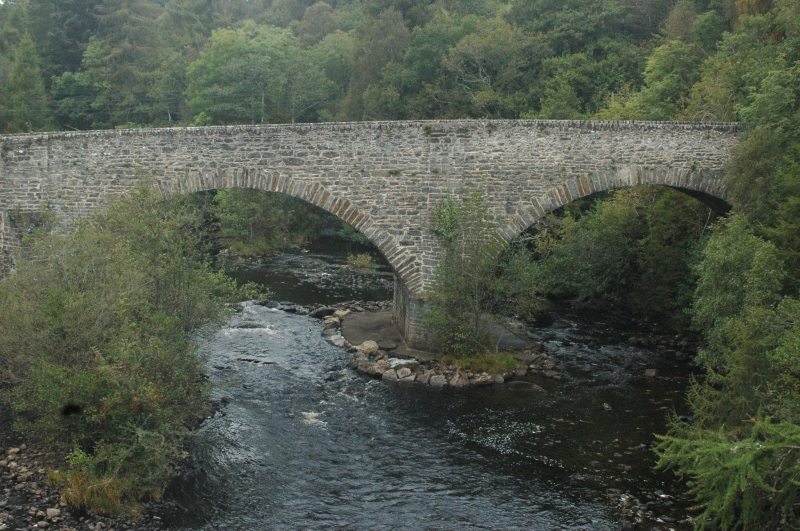
Thomas Telford, 1812/3 High arched bridge, rubble; 3 wide
segmental headed arch rings decreasing slightly in height and
span from east to west; triangular cutwaters carried up to
parapet height as shallow pilasters. Shallow end buttresses;
dressed rubble parapet.
Carries A832 road. First Parliamentary bridge destroyed by
flood in 1811 replanned and rebuilt in 1812 by the
Parliamentary Commissionery at Telford's insistence.
External links are from the relevant listing authority and, where applicable, Wikidata. Wikidata IDs may be related buildings as well as this specific building. If you want to add or update a link, you will need to do so by editing the Wikidata entry.


Other nearby listed buildings
