Approximate Location Map
Large Map »
Latitude: 57.8454 / 57°50'43"N
Longitude: -4.2918 / 4°17'30"W
OS Eastings: 264059
OS Northings: 886288
OS Grid: NH640862
Mapcode National: GBR H7SZ.LT4
Mapcode Global: WH3CL.12KH
Plus Code: 9C9QRPW5+57
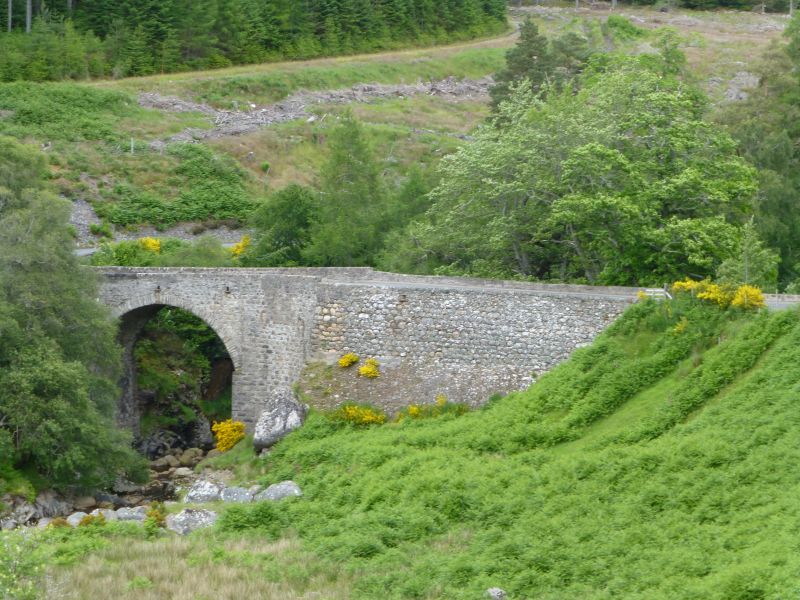
Entry Name: Bridge, Easter Fearn
Listing Name: Bridge over Easter Fearn Burn (On A836 Road)
Listing Date: 31 August 1983
Category: B
Source: Historic Scotland
Source ID: 332557
Historic Scotland Designation Reference: LB1809
Building Class: Cultural
Also known as: Easter Fearn Bridge
ID on this website: 200332557
Location: Edderton
County: Highland
Electoral Ward: East Sutherland and Edderton
Parish: Edderton
Tagged with: Bridge Road bridge
Thomas Telford, 1810-15. High single span arched bridge with
sharply angled western approach and long dry stone rubble
approach causeway from east. Coursed rubble, with dressed
rubble single arch ring and parapet.
External links are from the relevant listing authority and, where applicable, Wikidata. Wikidata IDs may be related buildings as well as this specific building. If you want to add or update a link, you will need to do so by editing the Wikidata entry.


Other nearby listed buildings
