Approximate Location Map
Large Map »
Latitude: 58.202 / 58°12'7"N
Longitude: -5.3362 / 5°20'10"W
OS Eastings: 204053
OS Northings: 928536
OS Grid: NC040285
Mapcode National: GBR F761.NHH
Mapcode Global: WH172.037M
Plus Code: 9CCP6M27+QG
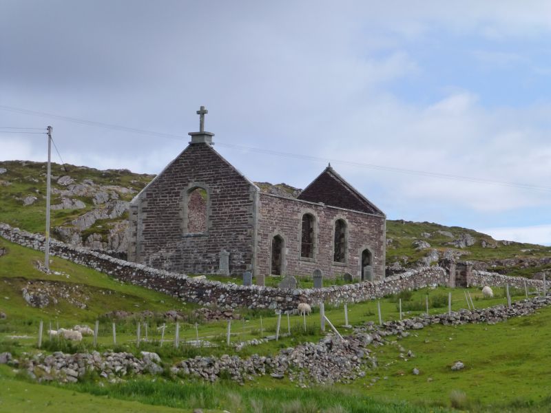
Entry Name: Stoer Church and Old Burial Ground
Listing Date: 18 March 1971
Category: C
Source: Historic Scotland
Source ID: 332580
Historic Scotland Designation Reference: LB1831
Building Class: Cultural
ID on this website: 200332580
Location: Assynt
County: Highland
Electoral Ward: North, West and Central Sutherland
Parish: Assynt
Traditional County: Sutherland
Tagged with: Church building
Thomas Telford, 1828. Standard Parliamentary T-plan church;
coursed rubble, contrasting tooled dressings.
Depressd arched paired doors in outer bays of south elevation;
similarly detailed paired centre windows; similar single
windows in end gables and rear wing. Gutted and roofless.
Church stands in small burial ground enclosed by rubble
drystone wall.
"Quoad sacra" parish of Stoer established in 1834.
External links are from the relevant listing authority and, where applicable, Wikidata. Wikidata IDs may be related buildings as well as this specific building. If you want to add or update a link, you will need to do so by editing the Wikidata entry.


Other nearby listed buildings
