Approximate Location Map
Large Map »
Latitude: 57.2197 / 57°13'10"N
Longitude: -4.4559 / 4°27'21"W
OS Eastings: 251803
OS Northings: 816995
OS Grid: NH518169
Mapcode National: GBR H9CM.X9W
Mapcode Global: WH3GD.JSCQ
Plus Code: 9C9Q6G9V+VJ
Entry Name: Garthbeg
Listing Name: Garthbeg
Listing Date: 17 April 1986
Category: B
Source: Historic Scotland
Source ID: 332653
Historic Scotland Designation Reference: LB1883
Building Class: Cultural
ID on this website: 200332653
Location: Boleskine and Abertarff
County: Highland
Electoral Ward: Aird and Loch Ness
Parish: Boleskine And Abertarff
Traditional County: Inverness-shire
Tagged with: Building
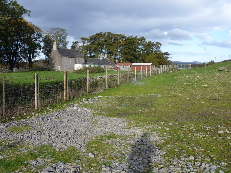
Circa 1800, symmetrical 2-storey, and attic, 3-bay house.
NW front with centre door masked by projecting square flat
roofed porch (modern felting to roof). 3 piended dormers;
single ground floor window in return SW gable window; 12-
pane glazing; end stacks; slate roof. Later long single
storey rubble wing extends across NE gable to rear, forming
L-plan rear; off-centre ridge stack; piended slate roof.
External links are from the relevant listing authority and, where applicable, Wikidata. Wikidata IDs may be related buildings as well as this specific building. If you want to add or update a link, you will need to do so by editing the Wikidata entry.


Other nearby listed buildings
