Approximate Location Map
Large Map »
Latitude: 55.6251 / 55°37'30"N
Longitude: -2.6728 / 2°40'22"W
OS Eastings: 357728
OS Northings: 637038
OS Grid: NT577370
Mapcode National: GBR 93SD.4D
Mapcode Global: WH7WJ.XWD3
Plus Code: 9C7VJ8GG+2V
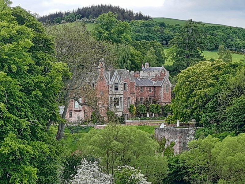
Entry Name: Cowdenknowes House
Listing Name: Cowdenknowes
Listing Date: 9 June 1971
Category: A
Source: Historic Scotland
Source ID: 332972
Historic Scotland Designation Reference: LB2120
Building Class: Cultural
Also known as: Cowdenknowes
ID on this website: 200332972
Location: Earlston
County: Scottish Borders
Electoral Ward: Leaderdale and Melrose
Parish: Earlston
Traditional County: Berwickshire
Tagged with: House Country house
In 16th century this mansion-house consisted of 3 distinct parts; a tower; mansion dated 1574; small tower now in ruins. All were originally connected by curtain walls and enclosing a courtyard now occupied as open gardens. A modern wing now connects the tower with the mansion house.
External links are from the relevant listing authority and, where applicable, Wikidata. Wikidata IDs may be related buildings as well as this specific building. If you want to add or update a link, you will need to do so by editing the Wikidata entry.


Other nearby listed buildings
