Approximate Location Map
Large Map »
Latitude: 57.5963 / 57°35'46"N
Longitude: -3.6963 / 3°41'46"W
OS Eastings: 298709
OS Northings: 857515
OS Grid: NH987575
Mapcode National: GBR K87N.3K6
Mapcode Global: WH5H9.6B3H
Plus Code: 9C9RH8W3+GF
Entry Name: Bridge, Muckle Burn, Barleymill
Listing Name: Barleymill Bridge over Muckle Burn
Listing Date: 9 November 1987
Category: B
Source: Historic Scotland
Source ID: 333143
Historic Scotland Designation Reference: LB2258
Building Class: Cultural
ID on this website: 200333143
Location: Dyke and Moy
County: Moray
Electoral Ward: Forres
Parish: Dyke And Moy
Traditional County: Morayshire
Tagged with: Road bridge
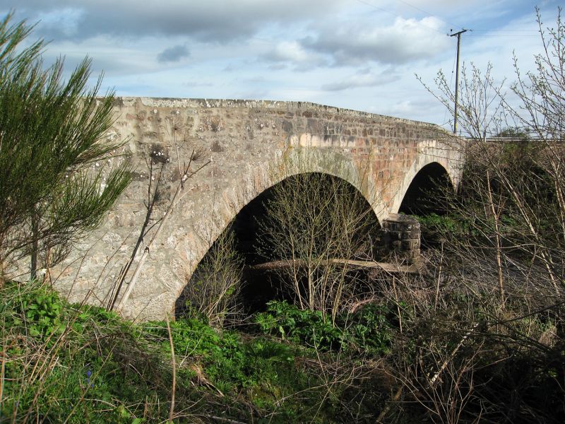
Circa 1830. Twin arched rubble bridge. Tooled rubble
segmental arch rings repaired with concrete W side. Rounded
cutwaters; tooled rubble abutments; low tooled ashlar cope to
parapet with splayed approaches.
Approximate span of each arch; 30'.
Probably replaced 'stout wooden bridge' which spanned the
Muckle Burn at Barley Mill by 1798 and which would have been
damaged or swept away during Moray floods, 1829.
External links are from the relevant listing authority and, where applicable, Wikidata. Wikidata IDs may be related buildings as well as this specific building. If you want to add or update a link, you will need to do so by editing the Wikidata entry.


Other nearby listed buildings
