Approximate Location Map
Large Map »
Latitude: 57.5966 / 57°35'47"N
Longitude: -3.7163 / 3°42'58"W
OS Eastings: 297514
OS Northings: 857581
OS Grid: NH975575
Mapcode National: GBR K86N.0DN
Mapcode Global: WH5H8.WBH7
Plus Code: 9C9RH7WM+JF
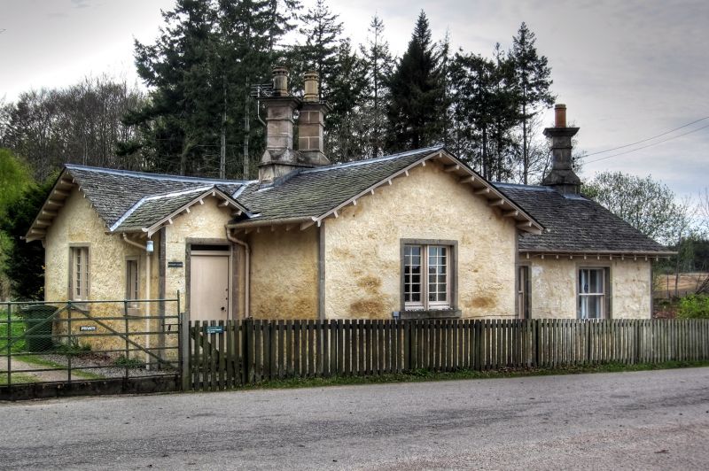
Entry Name: West Lodge, Brodie Castle
Listing Name: Brodie Castle, West Lodge
Listing Date: 9 November 1987
Category: C
Source: Historic Scotland
Source ID: 333148
Historic Scotland Designation Reference: LB2263
Building Class: Cultural
ID on this website: 200333148
Location: Dyke and Moy
County: Moray
Electoral Ward: Forres
Parish: Dyke And Moy
Traditional County: Morayshire
Tagged with: Gatehouse
1830-40. Single storey, irregular L-plan with 3-bay E
frontage (to road). White washed rubble, tooled ashlar
margins. Wide gabled bays S and E with porch in re-entrant
angle; some lying-pane glazing survives; 2- and 4-pane
replacements elsewhere; tall corniced ridge and end stacks;
shallow pitched slate roofs with projecting eaves.
External links are from the relevant listing authority and, where applicable, Wikidata. Wikidata IDs may be related buildings as well as this specific building. If you want to add or update a link, you will need to do so by editing the Wikidata entry.


Other nearby listed buildings
