Approximate Location Map
Large Map »
Latitude: 56.2915 / 56°17'29"N
Longitude: -2.9707 / 2°58'14"W
OS Eastings: 340015
OS Northings: 711429
OS Grid: NO400114
Mapcode National: GBR 2J.7QJH
Mapcode Global: WH7S9.B4M6
Plus Code: 9C8V72RH+HP
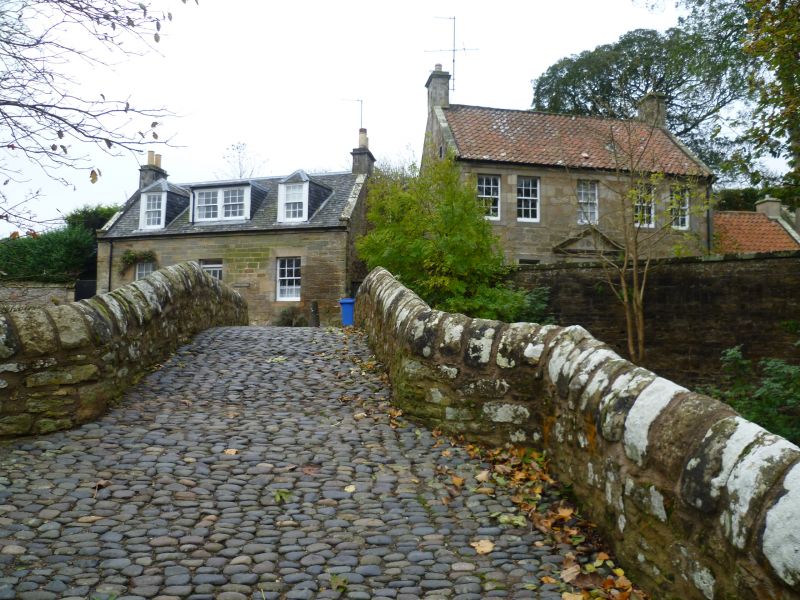
Entry Name: Bishop Bridge And Linking Wall To Folk Museum, Ceres Burn, High Street, Ceres
Listing Name: Bishop Bridge over Ceres Burn, Including Approach Walls Linking to Folk Museum, Ceres
Listing Date: 10 August 1972
Category: A
Source: Historic Scotland
Source ID: 333280
Historic Scotland Designation Reference: LB2366
Building Class: Cultural
Also known as: Bishop's Bridge, Ceres
ID on this website: 200333280
Location: Ceres
County: Fife
Electoral Ward: Cupar
Parish: Ceres
Traditional County: Fife
Tagged with: Bridge Road bridge
17th century. Single semi-circular arch 27' span, 6' between
the parapets, widening at the approaches. Rubble, chamfered
voussoirs, cobbled roadway.
External links are from the relevant listing authority and, where applicable, Wikidata. Wikidata IDs may be related buildings as well as this specific building. If you want to add or update a link, you will need to do so by editing the Wikidata entry.


Other nearby listed buildings
