Approximate Location Map
Large Map »
Latitude: 56.4013 / 56°24'4"N
Longitude: -3.0123 / 3°0'44"W
OS Eastings: 337617
OS Northings: 723682
OS Grid: NO376236
Mapcode National: GBR 2H.0M5X
Mapcode Global: WH7RP.PCRK
Plus Code: 9C8RCX2Q+G3
Entry Name: Balgove Farmhouse, 7 Balgove Road, Gauldry
Listing Name: Balgove Farmhouse, Gauldry
Listing Date: 22 October 1984
Category: C
Source: Historic Scotland
Source ID: 333480
Historic Scotland Designation Reference: LB2542
Building Class: Cultural
ID on this website: 200333480
Location: Balmerino
County: Fife
Electoral Ward: Tay Bridgehead
Parish: Balmerino
Traditional County: Fife
Tagged with: Architectural structure
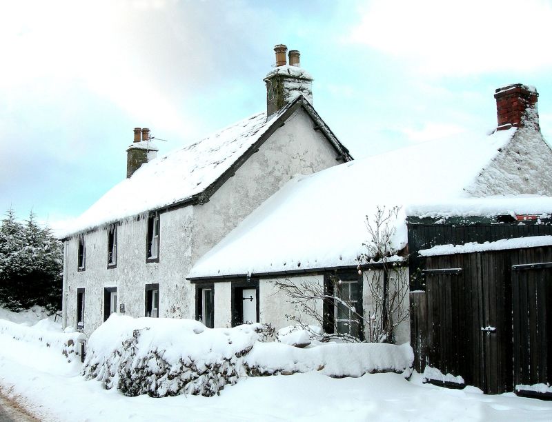
Early 19th century. Former tollhouse, inn and staging station.
Main part 2-storey 3-window harled with margins, moulded
doorpiece, slated roof with wide eaves; 2 window and centre
door pantiled single-storey outbuilding.
Former items 806-9 demolished or altered.
External links are from the relevant listing authority and, where applicable, Wikidata. Wikidata IDs may be related buildings as well as this specific building. If you want to add or update a link, you will need to do so by editing the Wikidata entry.


Other nearby listed buildings
