Approximate Location Map
Large Map »
Latitude: 57.4421 / 57°26'31"N
Longitude: -2.7115 / 2°42'41"W
OS Eastings: 357388
OS Northings: 839315
OS Grid: NJ573393
Mapcode National: GBR M9N1.QK9
Mapcode Global: WH7LT.B61M
Plus Code: 9C9VC7RQ+V9
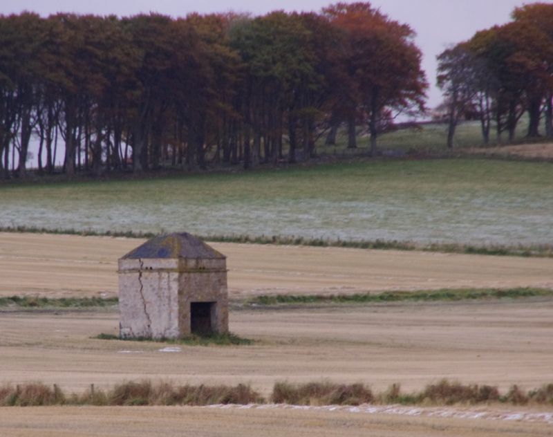
Entry Name: Dovecot, Mains Of Newtongarry
Listing Name: Mains of Newtongarry Dovecot.
Listing Date: 16 April 1971
Category: B
Source: Historic Scotland
Source ID: 333915
Historic Scotland Designation Reference: LB2941
Building Class: Cultural
ID on this website: 200333915
Location: Drumblade
County: Aberdeenshire
Electoral Ward: Huntly, Strathbogie and Howe of Alford
Parish: Drumblade
Traditional County: Aberdeenshire
Tagged with: Architectural structure
Probably mid 18th century. Large, square plan, rubble built,
pyramid roof with louvre, rat course. Slate boxes. Entrance
enlarged; badly cracked.
External links are from the relevant listing authority and, where applicable, Wikidata. Wikidata IDs may be related buildings as well as this specific building. If you want to add or update a link, you will need to do so by editing the Wikidata entry.


Other nearby listed buildings
