Approximate Location Map
Large Map »
Latitude: 57.074 / 57°4'26"N
Longitude: -2.335 / 2°20'6"W
OS Eastings: 379787
OS Northings: 798154
OS Grid: NO797981
Mapcode National: GBR XC.TD1F
Mapcode Global: WH8PW.3GCC
Plus Code: 9C9V3MF7+HX
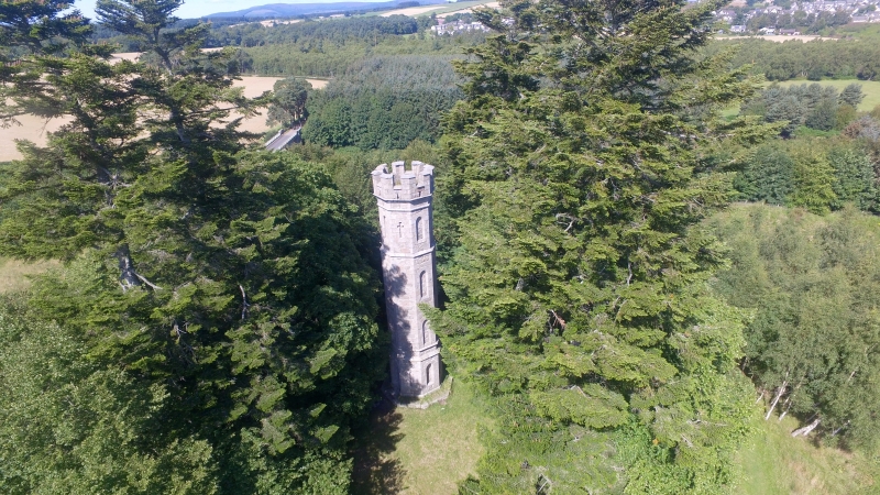
Entry Name: Keith's Tower
Listing Name: Keith's Tower
Listing Date: 18 August 1972
Category: B
Source: Historic Scotland
Source ID: 333954
Historic Scotland Designation Reference: LB2980
Building Class: Cultural
ID on this website: 200333954
Location: Durris
County: Aberdeenshire
Electoral Ward: Stonehaven and Lower Deeside
Parish: Durris
Traditional County: Kincardineshire
Tagged with: Tower
Octagonal gothic tower, ashlar, about 50 ft high with battlemented parapet and set in roundel of pine trees. Built by Duke of Gordon to commemorate winning of lawsuit, 1825 (dated).
External links are from the relevant listing authority and, where applicable, Wikidata. Wikidata IDs may be related buildings as well as this specific building. If you want to add or update a link, you will need to do so by editing the Wikidata entry.


Other nearby listed buildings
