Approximate Location Map
Large Map »
Latitude: 57.0963 / 57°5'46"N
Longitude: -2.3338 / 2°20'1"W
OS Eastings: 379873
OS Northings: 800644
OS Grid: NJ798006
Mapcode National: GBR XC.RSDR
Mapcode Global: WH8PP.3WYR
Plus Code: 9C9V3MW8+GF
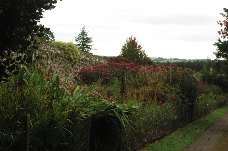
Entry Name: Walled Garden, Drum Castle
Listing Name: Drum Castle, Walled Garden
Listing Date: 25 November 1980
Category: B
Source: Historic Scotland
Source ID: 334099
Historic Scotland Designation Reference: LB3115
Building Class: Cultural
ID on this website: 200334099
Location: Drumoak
County: Aberdeenshire
Electoral Ward: Stonehaven and Lower Deeside
Parish: Drumoak
Traditional County: Aberdeenshire
Tagged with: Walled garden
Probably late 18th century. Rectangular, rubble built, coping slopes to outside with brick capping.
Laundry building of c 1800 adjoins.
External links are from the relevant listing authority and, where applicable, Wikidata. Wikidata IDs may be related buildings as well as this specific building. If you want to add or update a link, you will need to do so by editing the Wikidata entry.


Other nearby listed buildings
