Approximate Location Map
Large Map »
Latitude: 56.0559 / 56°3'21"N
Longitude: -3.3383 / 3°20'17"W
OS Eastings: 316752
OS Northings: 685590
OS Grid: NT167855
Mapcode National: GBR 22.QKZ0
Mapcode Global: WH6S4.P1JS
Plus Code: 9C8R3M46+9M
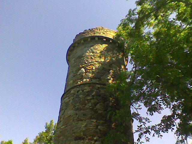
Entry Name: Mount Laura Tower
Listing Name: Mount Laura Tower
Listing Date: 19 December 1979
Category: C
Source: Historic Scotland
Source ID: 334776
Historic Scotland Designation Reference: LB3656
Building Class: Cultural
ID on this website: 200334776
Location: Dalgety
County: Fife
Electoral Ward: Inverkeithing and Dalgety Bay
Parish: Dalgety
Traditional County: Fife
Tagged with: Building
Round 19th cent. look-out tower built of rubble. Corbelled
parapet. (partly gone) 2 string-courses. Slit-windows.
Turnpike-stair
External links are from the relevant listing authority and, where applicable, Wikidata. Wikidata IDs may be related buildings as well as this specific building. If you want to add or update a link, you will need to do so by editing the Wikidata entry.


Other nearby listed buildings
