Approximate Location Map
Large Map »
Latitude: 55.5162 / 55°30'58"N
Longitude: -2.6009 / 2°36'3"W
OS Eastings: 362150
OS Northings: 624885
OS Grid: NT621248
Mapcode National: GBR B48N.PD
Mapcode Global: WH8Y9.0MQ1
Plus Code: 9C7VG98X+FJ
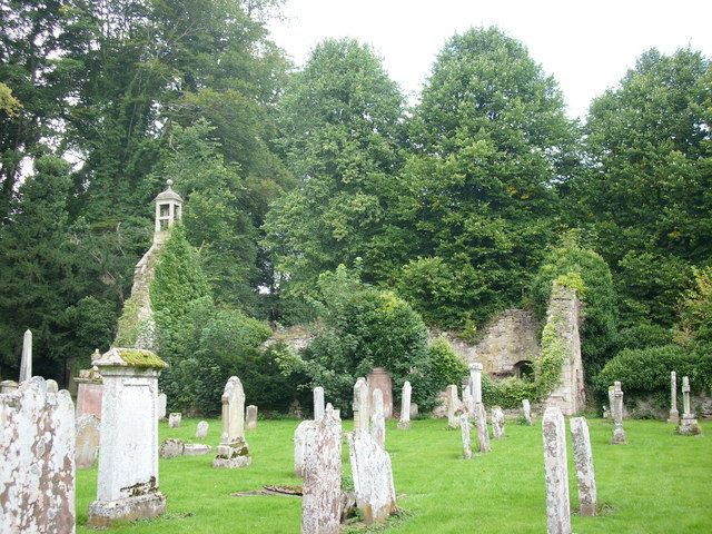
Entry Name: Old Ancrum Church, Ancrum
Listing Name: Remains of Old Ancrum Church
Listing Date: 16 March 1971
Category: B
Source: Historic Scotland
Source ID: 335478
Historic Scotland Designation Reference: LB4239
Building Class: Cultural
Also known as: Ancrum, Old Ancrum Church
ID on this website: 200335478
Location: Ancrum
County: Scottish Borders
Electoral Ward: Jedburgh and District
Parish: Ancrum
Traditional County: Roxburghshire
Tagged with: Church building
1762; repaired 1832, fragmentary, 1756 aisle at east end; 1618 Burgerhuys bell in present Kirk.
External links are from the relevant listing authority and, where applicable, Wikidata. Wikidata IDs may be related buildings as well as this specific building. If you want to add or update a link, you will need to do so by editing the Wikidata entry.


Other nearby listed buildings
