Approximate Location Map
Large Map »
Latitude: 56.7248 / 56°43'29"N
Longitude: -2.5406 / 2°32'26"W
OS Eastings: 367014
OS Northings: 759370
OS Grid: NO670593
Mapcode National: GBR X2.H6S3
Mapcode Global: WH8RH.Y7CH
Plus Code: 9C8VPFF5+WQ
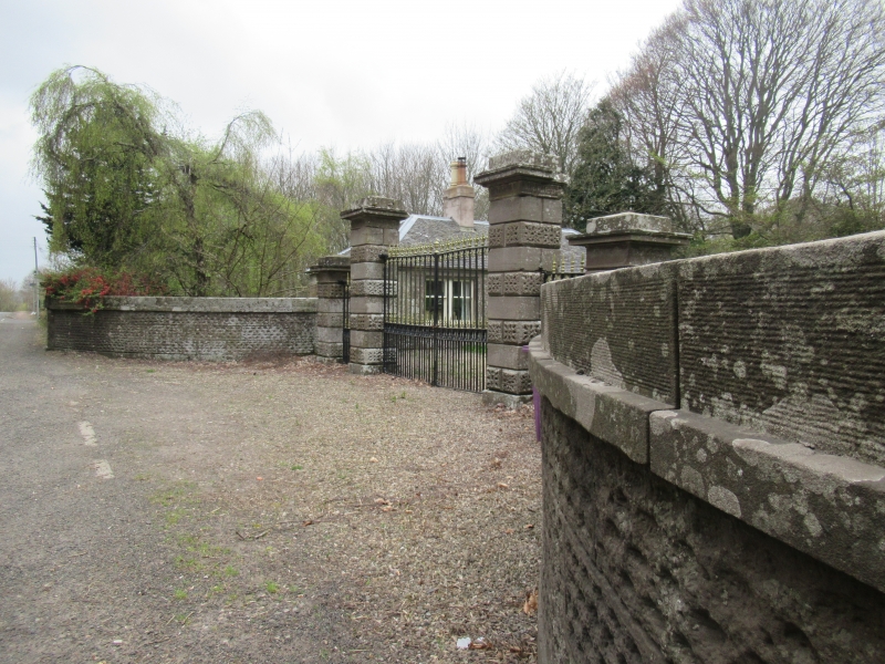
Entry Name: West Lodge And Gates, House Of Dun
Listing Name: House of Dun West Gates
Listing Date: 11 June 1971
Category: B
Source: Historic Scotland
Source ID: 335948
Historic Scotland Designation Reference: LB4668
Building Class: Cultural
ID on this website: 200335948
Location: Dun
County: Angus
Electoral Ward: Montrose and District
Parish: Dun
Traditional County: Angus
Tagged with: Architectural structure
4 piers, centre pair higher with acanthus cyma recta
under cornice. Banded rustication, rusticated curved
flank walls. Simple iron gates: c.1835.
External links are from the relevant listing authority and, where applicable, Wikidata. Wikidata IDs may be related buildings as well as this specific building. If you want to add or update a link, you will need to do so by editing the Wikidata entry.


Other nearby listed buildings
