Approximate Location Map
Large Map »
Latitude: 56.7296 / 56°43'46"N
Longitude: -2.5443 / 2°32'39"W
OS Eastings: 366794
OS Northings: 759898
OS Grid: NO667598
Mapcode National: GBR X1.75VR
Mapcode Global: WH8RH.W3MW
Plus Code: 9C8VPFH4+R7
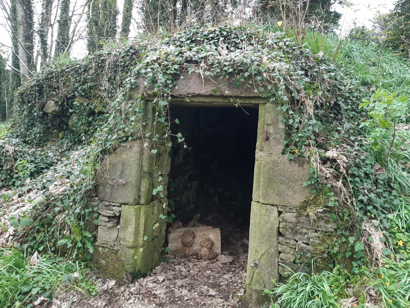
Entry Name: Den Wood Icehouse
Listing Name: Icehouse in Den Wood N.w. of Den of Dun Bridge
Listing Date: 11 June 1971
Category: B
Source: Historic Scotland
Source ID: 335953
Historic Scotland Designation Reference: LB4673
Building Class: Cultural
ID on this website: 200335953
Location: Dun
County: Angus
Electoral Ward: Montrose and District
Parish: Dun
Traditional County: Angus
Tagged with: Icehouse
Small, stone-built with exposed extrados: small arched
opening towards burn, and another in the extrados.
? 18th cent. or earlier.
External links are from the relevant listing authority and, where applicable, Wikidata. Wikidata IDs may be related buildings as well as this specific building. If you want to add or update a link, you will need to do so by editing the Wikidata entry.


Other nearby listed buildings
