Approximate Location Map
Large Map »
Latitude: 56.4894 / 56°29'21"N
Longitude: -5.4414 / 5°26'28"W
OS Eastings: 188230
OS Northings: 738342
OS Grid: NM882383
Mapcode National: GBR DCYK.NB5
Mapcode Global: WH0G6.D43Z
Plus Code: 9C8PFHQ5+QC
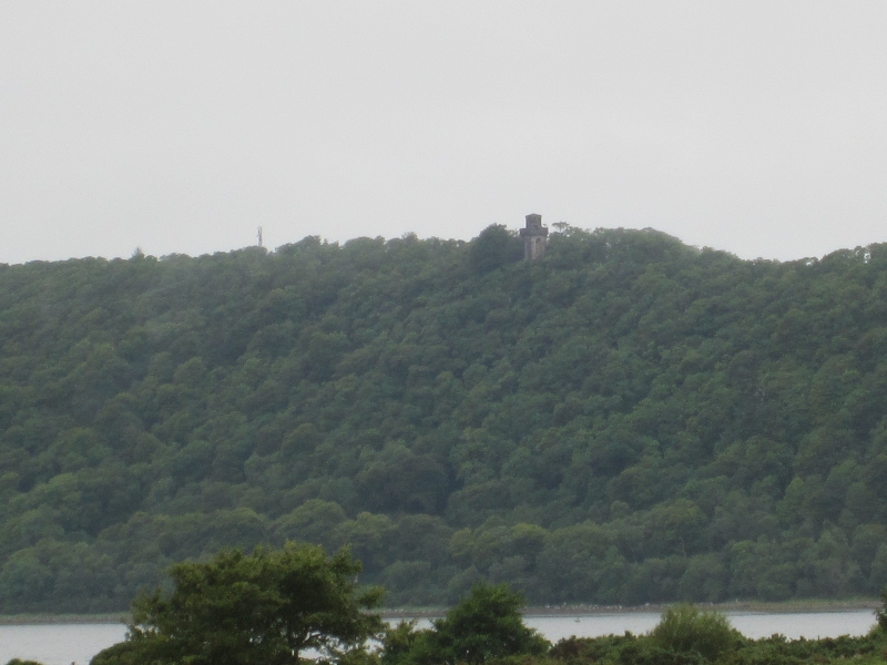
Entry Name: Lady Margaret's Tower Observatory, Lochnell
Listing Name: Lochnell Observatory (St. Margaret's Tower) Lochnell Policies
Listing Date: 28 August 1980
Category: A
Source: Historic Scotland
Source ID: 335998
Historic Scotland Designation Reference: LB4717
Building Class: Cultural
Also known as: Lochnell, Lady Margaret's Tower
ID on this website: 200335998
Location: Ardchattan and Muckairn
County: Argyll and Bute
Electoral Ward: Oban North and Lorn
Parish: Ardchattan And Muckairn
Traditional County: Argyllshire
Tagged with: Tower
Earlier 19th cent. Polygonal. Rubble.
Burnt out 1850.
External links are from the relevant listing authority and, where applicable, Wikidata. Wikidata IDs may be related buildings as well as this specific building. If you want to add or update a link, you will need to do so by editing the Wikidata entry.


Other nearby listed buildings
