Approximate Location Map
Large Map »
Latitude: 56.5767 / 56°34'35"N
Longitude: -2.5894 / 2°35'21"W
OS Eastings: 363888
OS Northings: 742901
OS Grid: NO638429
Mapcode National: GBR VV.MNL0
Mapcode Global: WH8S2.6Y7N
Plus Code: 9C8VHCG6+M6
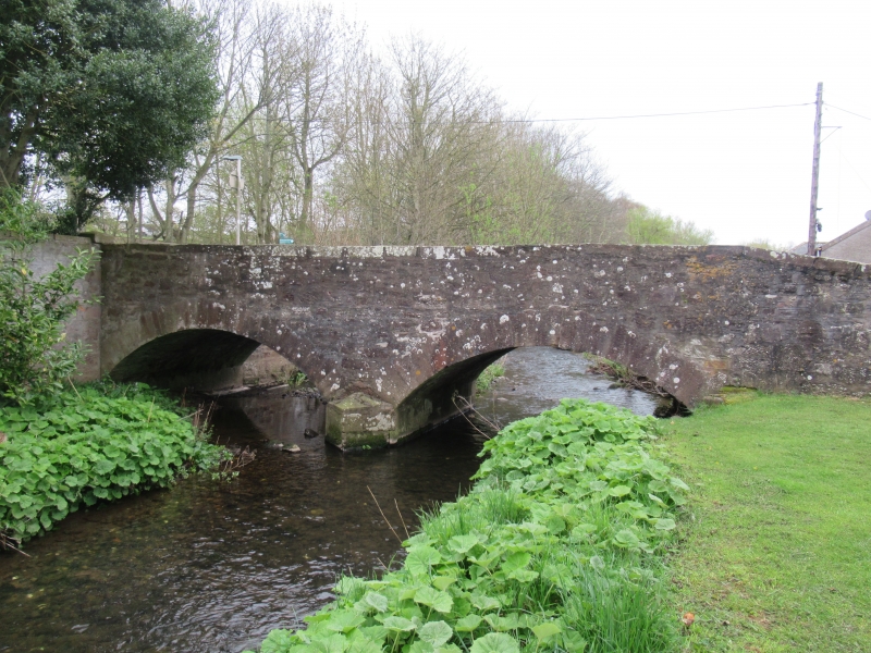
Entry Name: Bridge, St Vigeans
Listing Name: St. Vigeans Bridge over Brothock Burn
Listing Date: 11 June 1971
Category: B
Source: Historic Scotland
Source ID: 336069
Historic Scotland Designation Reference: LB4773
Building Class: Cultural
ID on this website: 200336069
Location: Arbroath and St Vigeans
County: Angus
Electoral Ward: Arbroath West, Letham and Friockheim
Parish: Arbroath And St Vigeans
Traditional County: Angus
Tagged with: Bridge Road bridge
Two segmental arch, rubble, with cutwater and parapets
widening at approaches. 18th cent., altered c.1840.
External links are from the relevant listing authority and, where applicable, Wikidata. Wikidata IDs may be related buildings as well as this specific building. If you want to add or update a link, you will need to do so by editing the Wikidata entry.


Other nearby listed buildings
