Approximate Location Map
Large Map »
Latitude: 56.0691 / 56°4'8"N
Longitude: -6.2011 / 6°12'3"W
OS Eastings: 138633
OS Northings: 694211
OS Grid: NR386942
Mapcode National: GBR CD2N.VTS
Mapcode Global: WGYFH.QQ96
Plus Code: 9C8M3Q9X+JH
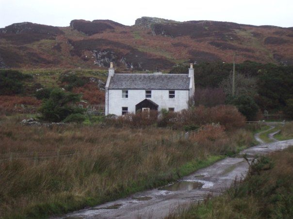
Entry Name: Scalasaig Farm, Scalasaig, Colonsay
Listing Name: Scalasaig Farm-House, Scalasaig.
Listing Date: 20 July 1971
Category: B
Source: Historic Scotland
Source ID: 336226
Historic Scotland Designation Reference: LB4913
Building Class: Cultural
ID on this website: 200336226
Location: Colonsay and Oronsay
County: Argyll and Bute
Electoral Ward: Kintyre and the Islands
Parish: Colonsay And Oronsay
Traditional County: Argyllshire
Tagged with: Farmhouse
Earlier 19th century. Traditional. 2 storeys; 3 windows
wide. Rubble, lime-washed. Gabled. Slate roof. Skews.
Gabled wing at rear.
External links are from the relevant listing authority and, where applicable, Wikidata. Wikidata IDs may be related buildings as well as this specific building. If you want to add or update a link, you will need to do so by editing the Wikidata entry.


Other nearby listed buildings
