Approximate Location Map
Large Map »
Latitude: 56.6894 / 56°41'21"N
Longitude: -2.7818 / 2°46'54"W
OS Eastings: 352212
OS Northings: 755571
OS Grid: NO522555
Mapcode National: GBR VP.HRTH
Mapcode Global: WH7QG.74L4
Plus Code: 9C8VM6Q9+Q7
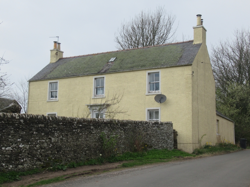
Entry Name: Kirkton, Aberlemno
Listing Name: Kirkton Farmhouse
Listing Date: 11 June 1971
Category: C
Source: Historic Scotland
Source ID: 336265
Historic Scotland Designation Reference: LB4951
Building Class: Cultural
ID on this website: 200336265
Location: Aberlemno
County: Angus
Electoral Ward: Brechin and Edzell
Parish: Aberlemno
Traditional County: Angus
Tagged with: Farmhouse
Plain two-storey, (formerly single-storey), harl and
slate. c. 1840.
Re-categorised as C(S) from B for Group. The listing refers specifically to the group interest of the subject. It applies, as always, to interior as well as exterior, as appropriate to building type.
External links are from the relevant listing authority and, where applicable, Wikidata. Wikidata IDs may be related buildings as well as this specific building. If you want to add or update a link, you will need to do so by editing the Wikidata entry.


Other nearby listed buildings
