Approximate Location Map
Large Map »
Latitude: 56.374 / 56°22'26"N
Longitude: -3.9872 / 3°59'13"W
OS Eastings: 277365
OS Northings: 721961
OS Grid: NN773219
Mapcode National: GBR 19.2B7M
Mapcode Global: WH4N0.Q1JY
Plus Code: 9C8R92F7+H4
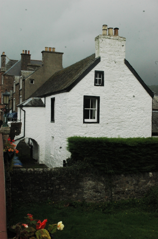
Entry Name: Earnside, Bridge Street, Comrie
Listing Name: Earnside (Peter W Mills) Bridge Street.
Listing Date: 18 October 1977
Category: C
Source: Historic Scotland
Source ID: 336765
Historic Scotland Designation Reference: LB5347
Building Class: Cultural
ID on this website: 200336765
Location: Comrie
County: Perth and Kinross
Electoral Ward: Strathearn
Parish: Comrie
Traditional County: Perthshire
Tagged with: Architectural structure
18th century. Single-storey and laigh floor, painted rubble,
2-window and centre piended porch on arched flyover, left
hand window unfortunately altered: slated.
External links are from the relevant listing authority and, where applicable, Wikidata. Wikidata IDs may be related buildings as well as this specific building. If you want to add or update a link, you will need to do so by editing the Wikidata entry.


Other nearby listed buildings
