Approximate Location Map
Large Map »
Latitude: 56.566 / 56°33'57"N
Longitude: -3.5853 / 3°35'7"W
OS Eastings: 302676
OS Northings: 742685
OS Grid: NO026426
Mapcode National: GBR V2.RBZD
Mapcode Global: WH5NC.W7W8
Plus Code: 9C8RHC87+CV
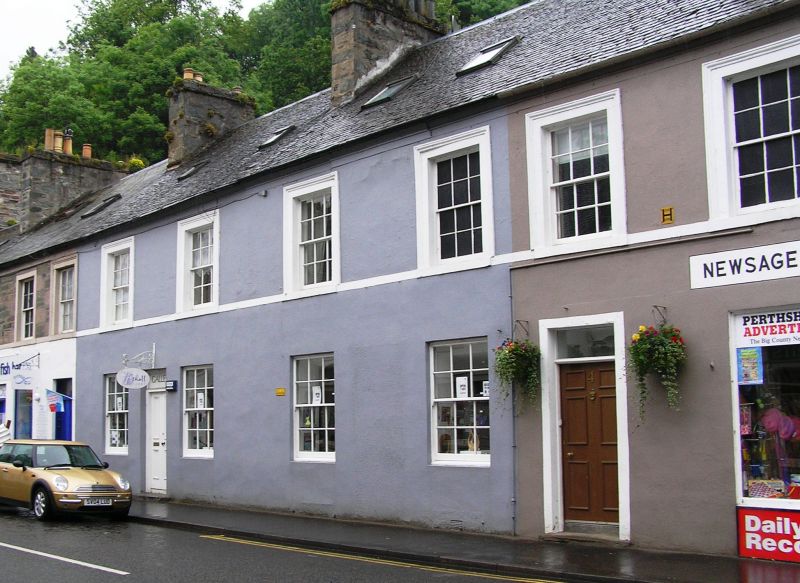
Entry Name: Atholl Street, Dunkeld
Listing Name: T.i. Stanton to Scottish Gas Board, Atholl Street, (E.).
Listing Date: 5 October 1971
Category: C
Source: Historic Scotland
Source ID: 337069
Historic Scotland Designation Reference: LB5587
Building Class: Cultural
ID on this website: 200337069
Location: Dunkeld and Dowally
County: Perth and Kinross
Electoral Ward: Strathtay
Parish: Dunkeld And Dowally
Traditional County: Perthshire
Tagged with: Architectural structure
2-storey block, ground floor partly shops, rubble-built
partially stuccoed with architraves. Irregular spacing of
fenestration. Some doorways have original fanlights.
Re-categorised as C(S) from B for Group (2006). The listing relates specifically to the group interest of the subject. It applies, as always, to interior as well as exterior, as appropriate to building type.
External links are from the relevant listing authority and, where applicable, Wikidata. Wikidata IDs may be related buildings as well as this specific building. If you want to add or update a link, you will need to do so by editing the Wikidata entry.


Other nearby listed buildings
