Approximate Location Map
Large Map »
Latitude: 56.5637 / 56°33'49"N
Longitude: -3.5954 / 3°35'43"W
OS Eastings: 302050
OS Northings: 742448
OS Grid: NO020424
Mapcode National: GBR V2.RGM4
Mapcode Global: WH5NC.R920
Plus Code: 9C8RHC73+FR
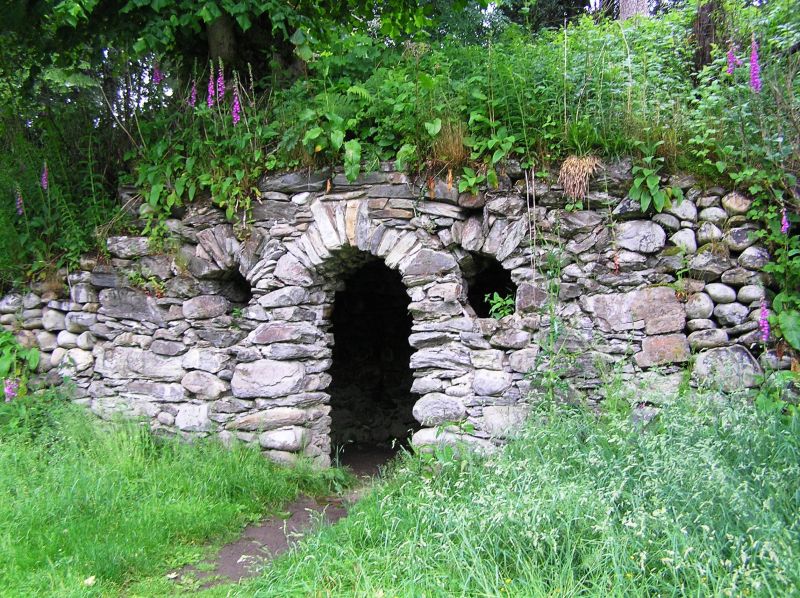
Entry Name: East Grotto, Dunkeld House, Dunkeld
Listing Name: Dunkeld House, East Grotto. (The Mousetrap)
Listing Date: 5 October 1971
Category: B
Source: Historic Scotland
Source ID: 337090
Historic Scotland Designation Reference: LB5607
Building Class: Cultural
ID on this website: 200337090
Location: Dunkeld and Dowally
County: Perth and Kinross
Electoral Ward: Strathtay
Parish: Dunkeld And Dowally
Traditional County: Perthshire
Tagged with: Grotto
Domed chamber sunk into embankment by river; rustic front of
boulder rubble, round arched doorway flanked by two
round-headed windows" 18th/
External links are from the relevant listing authority and, where applicable, Wikidata. Wikidata IDs may be related buildings as well as this specific building. If you want to add or update a link, you will need to do so by editing the Wikidata entry.


Other nearby listed buildings
