Approximate Location Map
Large Map »
Latitude: 56.5656 / 56°33'56"N
Longitude: -3.5848 / 3°35'5"W
OS Eastings: 302705
OS Northings: 742638
OS Grid: NO027426
Mapcode National: GBR V2.RC34
Mapcode Global: WH5NC.X73L
Plus Code: 9C8RHC88+63
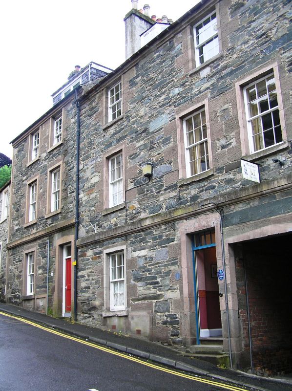
Entry Name: Brae Street, Dunkeld
Listing Name: J.b. Robertson, Brae St. (S.)
Listing Date: 5 October 1971
Category: C
Source: Historic Scotland
Source ID: 337112
Historic Scotland Designation Reference: LB5627
Building Class: Cultural
ID on this website: 200337112
Location: Dunkeld and Dowally
County: Perth and Kinross
Electoral Ward: Strathtay
Parish: Dunkeld And Dowally
Traditional County: Perthshire
Tagged with: Architectural structure
3-storey and attics, 2/3-window rubble with margins c.1840.
Re-categorised as C(S) from B for Group (2006). The listing relates specifically to the group interest of the subject. It applies, as always, to interior as well as exterior, as appropriate to building type.
External links are from the relevant listing authority and, where applicable, Wikidata. Wikidata IDs may be related buildings as well as this specific building. If you want to add or update a link, you will need to do so by editing the Wikidata entry.


Other nearby listed buildings
