Approximate Location Map
Large Map »
Latitude: 56.5655 / 56°33'55"N
Longitude: -3.5873 / 3°35'14"W
OS Eastings: 302556
OS Northings: 742633
OS Grid: NO025426
Mapcode National: GBR V2.RBJ9
Mapcode Global: WH5NC.V7YN
Plus Code: 9C8RHC87+63
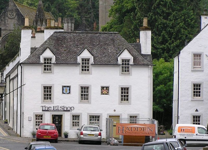
Entry Name: The Ell House, 9 High Street, Dunkeld
Listing Name: 'The Ell House', the Cross, High Street (W.)
Listing Date: 5 October 1971
Category: B
Source: Historic Scotland
Source ID: 337131
Historic Scotland Designation Reference: LB5646
Building Class: Cultural
ID on this website: 200337131
Location: Dunkeld and Dowally
County: Perth and Kinross
Electoral Ward: Strathtay
Parish: Dunkeld And Dowally
Traditional County: Perthshire
Tagged with: Building
Former St. George's Hospital: 3-storey harled with margins, piended roof, 3 gabled dormer heads to 2nd floor windows; ground floor shops. Described as newly-built in a document of 1757.
Ell or Weaver's measure (metal gauge) fixed to outside of shop. For Cathedral Street wing of the Hospital see Item 3.
External links are from the relevant listing authority and, where applicable, Wikidata. Wikidata IDs may be related buildings as well as this specific building. If you want to add or update a link, you will need to do so by editing the Wikidata entry.


Other nearby listed buildings
