Approximate Location Map
Large Map »
Latitude: 55.8996 / 55°53'58"N
Longitude: -3.2948 / 3°17'41"W
OS Eastings: 319134
OS Northings: 668145
OS Grid: NT191681
Mapcode National: GBR 50F7.G0
Mapcode Global: WH6SR.CZ85
Plus Code: 9C7RVPX4+R3
Entry Name: East Mills Bridge, Water Of Leith, Blinkbonny Road, Currie
Listing Name: Kinleith Bridge Water of Leith
Listing Date: 30 January 1981
Category: B
Source: Historic Scotland
Source ID: 337192
Historic Scotland Designation Reference: LB5706
Building Class: Cultural
Also known as: Currie, Blinkbonny Road, Water Of Leith, East Mills Bridge
ID on this website: 200337192
Location: Currie
County: Edinburgh
Electoral Ward: Pentland Hills
Parish: Currie
Traditional County: Midlothian
Tagged with: Road bridge
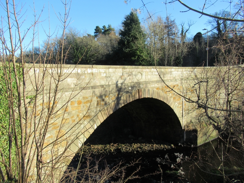
1831 (dated). Large single segmental arch, raised channel
jointed voussoirs rubble spandrels, ashlar parapets with oval inscription panels at centre, angled northern approach.
Built at the expense of General Scott of Malleny
External links are from the relevant listing authority and, where applicable, Wikidata. Wikidata IDs may be related buildings as well as this specific building. If you want to add or update a link, you will need to do so by editing the Wikidata entry.


Other nearby listed buildings
