Approximate Location Map
Large Map »
Latitude: 56.6666 / 56°39'59"N
Longitude: -3.9955 / 3°59'43"W
OS Eastings: 277798
OS Northings: 754533
OS Grid: NN777545
Mapcode National: GBR JCH3.4J6
Mapcode Global: WH4LG.LPLQ
Plus Code: 9C8RM283+JQ
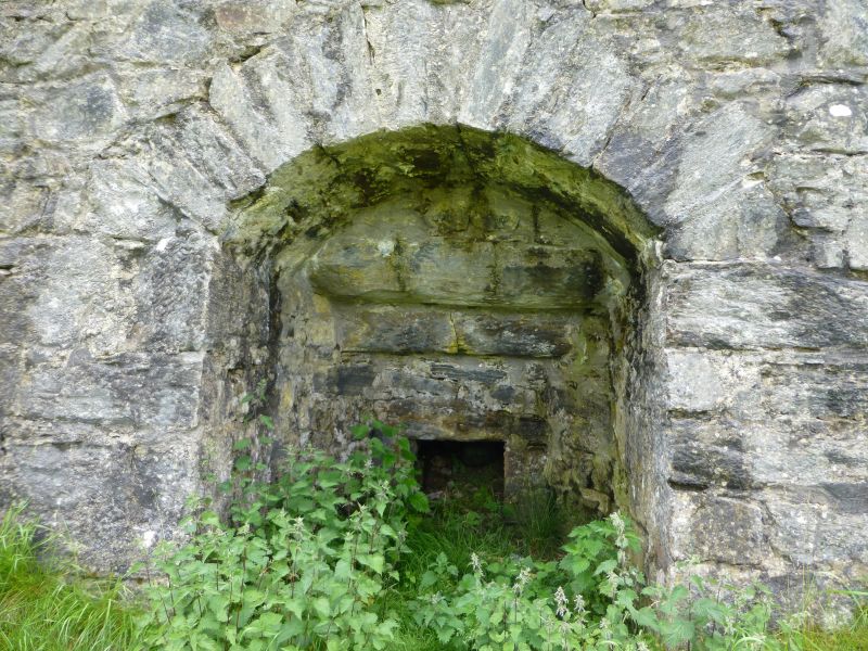
Entry Name: Limekiln, Tomphabil
Listing Name: Tomphubil Limekiln.
Listing Date: 5 October 1971
Category: B
Source: Historic Scotland
Source ID: 337228
Historic Scotland Designation Reference: LB5741
Building Class: Cultural
ID on this website: 200337228
Location: Dull
County: Perth and Kinross
Electoral Ward: Highland
Parish: Dull
Traditional County: Perthshire
Tagged with: Lime kiln
Square type, large rubble-built with segmentally arched fire
hole recess.
External links are from the relevant listing authority and, where applicable, Wikidata. Wikidata IDs may be related buildings as well as this specific building. If you want to add or update a link, you will need to do so by editing the Wikidata entry.


