Approximate Location Map
Large Map »
Latitude: 56.7698 / 56°46'11"N
Longitude: -3.8349 / 3°50'5"W
OS Eastings: 287951
OS Northings: 765743
OS Grid: NN879657
Mapcode National: GBR JBXT.L2X
Mapcode Global: WH5M9.234K
Plus Code: 9C8RQ598+W3
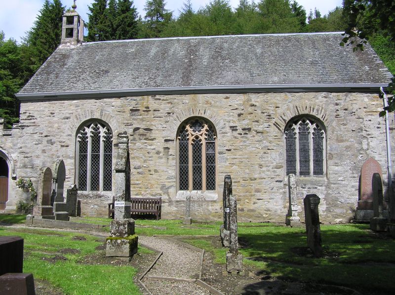
Entry Name: Church, Kilmaveonaig
Listing Name: Kilmaveonaig Chapel (Episcopal)
Listing Date: 5 October 1971
Category: B
Source: Historic Scotland
Source ID: 337642
Historic Scotland Designation Reference: LB6112
Building Class: Cultural
ID on this website: 200337642
Location: Blair Atholl
County: Perth and Kinross
Electoral Ward: Highland
Parish: Blair Atholl
Traditional County: Perthshire
Tagged with: Church building
Rectangular rubble-built dated 'AR AG 1591' on S. flank.
Rebuilt 1794 to designs of John Stewart, Charles
Robertson master mason: windows traceried 1866-71 and
1899, narthex (gothic) 1899: reredos 1912. Alex.
Robertson slab of 1634.
Ecclesiastical building in use as such.
External links are from the relevant listing authority and, where applicable, Wikidata. Wikidata IDs may be related buildings as well as this specific building. If you want to add or update a link, you will need to do so by editing the Wikidata entry.


Other nearby listed buildings
