Approximate Location Map
Large Map »
Latitude: 59.1287 / 59°7'43"N
Longitude: -3.3156 / 3°18'56"W
OS Eastings: 324800
OS Northings: 1027622
OS Grid: HY248276
Mapcode National: GBR L45L.XK1
Mapcode Global: WH692.1TF6
Plus Code: 9CFR4MHM+FQ
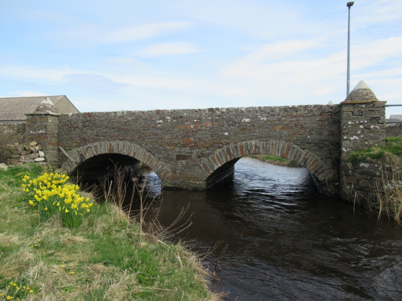
Entry Name: Bridge, Birsay
Listing Name: Birsay Bridge
Listing Date: 8 December 1971
Category: C
Source: Historic Scotland
Source ID: 337703
Historic Scotland Designation Reference: LB6173
Building Class: Cultural
ID on this website: 200337703
Location: Birsay and Harray
County: Orkney Islands
Electoral Ward: West Mainland
Parish: Birsay And Harray
Traditional County: Orkney
Tagged with: Road bridge Stone arch bridge
Lower part with 2 arches is 17th cent; upper is dated 1872.
Rubble.
External links are from the relevant listing authority and, where applicable, Wikidata. Wikidata IDs may be related buildings as well as this specific building. If you want to add or update a link, you will need to do so by editing the Wikidata entry.


Other nearby listed buildings
