Approximate Location Map
Large Map »
Latitude: 55.9409 / 55°56'27"N
Longitude: -2.3697 / 2°22'10"W
OS Eastings: 377005
OS Northings: 672044
OS Grid: NT770720
Mapcode National: GBR NFH0.K3V
Mapcode Global: WH8W8.KYS0
Plus Code: 9C7VWJRJ+94
Entry Name: Merse Lodge
Listing Name: Dunglass Policies, Merse Lodge
Listing Date: 23 April 1979
Category: C
Source: Historic Scotland
Source ID: 337991
Historic Scotland Designation Reference: LB6414
Building Class: Cultural
ID on this website: 200337991
Location: Cockburnspath
County: Scottish Borders
Electoral Ward: East Berwickshire
Parish: Cockburnspath
Traditional County: Berwickshire
Tagged with: Lodge
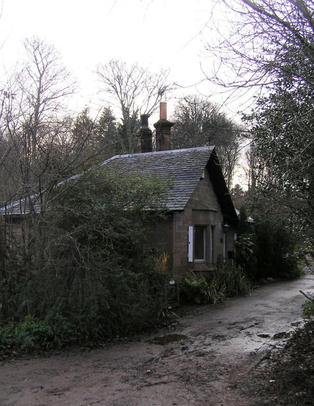
19th century. Single storey. Ashlar and rubble. Slated roof with deep eaves. East half has gable facing drive and bay-window.
External links are from the relevant listing authority and, where applicable, Wikidata. Wikidata IDs may be related buildings as well as this specific building. If you want to add or update a link, you will need to do so by editing the Wikidata entry.


Other nearby listed buildings
