Approximate Location Map
Large Map »
Latitude: 57.278 / 57°16'40"N
Longitude: -5.5197 / 5°31'10"W
OS Eastings: 187933
OS Northings: 826308
OS Grid: NG879263
Mapcode National: GBR D9RH.2H3
Mapcode Global: WH0B9.5BVF
Plus Code: 9C9P7FHJ+64
Entry Name: Slipway, Ardelve
Listing Name: Ardelve, Slipway
Listing Date: 25 March 1971
Category: B
Source: Historic Scotland
Source ID: 338762
Historic Scotland Designation Reference: LB6998
Building Class: Cultural
ID on this website: 200338762
Location: Lochalsh
County: Highland
Electoral Ward: Wester Ross, Strathpeffer and Lochalsh
Parish: Lochalsh
Traditional County: Ross-shire
Tagged with: Slipway
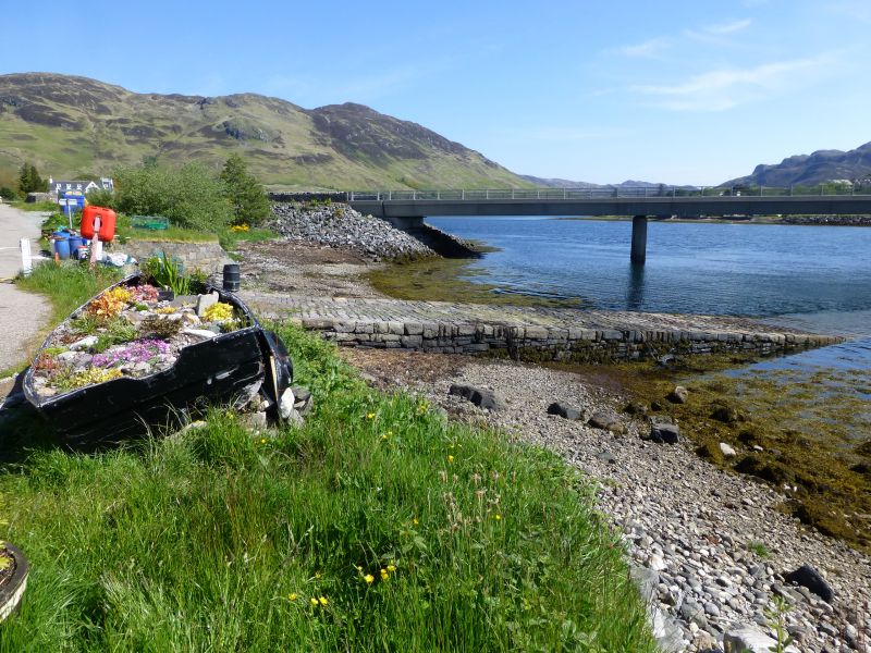
Early 19th century, rubble slipway; roughly dressed blocks
hold outer edges.
Served former ferry across Loch Long from Ardelve to Dornie.
Appear in original state.
External links are from the relevant listing authority and, where applicable, Wikidata. Wikidata IDs may be related buildings as well as this specific building. If you want to add or update a link, you will need to do so by editing the Wikidata entry.


Other nearby listed buildings
