Approximate Location Map
Large Map »
Latitude: 57.4502 / 57°27'0"N
Longitude: -5.4063 / 5°24'22"W
OS Eastings: 195724
OS Northings: 845106
OS Grid: NG957451
Mapcode National: GBR F911.0DJ
Mapcode Global: WH09K.X0RG
Plus Code: 9C9PFH2V+3F
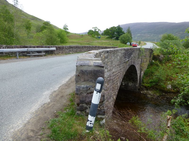
Entry Name: Coulags Bridge
Listing Name: Coulags Bridge over Fionn-Ahainn River
Listing Date: 25 March 1971
Category: C
Source: Historic Scotland
Source ID: 339099
Historic Scotland Designation Reference: LB7255
Building Class: Cultural
ID on this website: 200339099
Location: Lochcarron
County: Highland
Electoral Ward: Wester Ross, Strathpeffer and Lochalsh
Parish: Lochcarron
Traditional County: Ross-shire
Tagged with: Road bridge
Thomas Telford, circa 1815; rebuilt or extensively repaired
to original design, 1880. Single span bridge, rubble; dressed
rubble arch ring and parapet cope; spayed approaches; shallow
end buttresses.
On Contin-Strome Ferry Parliamentary road built between
1813 and 1819.
External links are from the relevant listing authority and, where applicable, Wikidata. Wikidata IDs may be related buildings as well as this specific building. If you want to add or update a link, you will need to do so by editing the Wikidata entry.


