Approximate Location Map
Large Map »
Latitude: 55.8569 / 55°51'24"N
Longitude: -3.4281 / 3°25'41"W
OS Eastings: 310703
OS Northings: 663553
OS Grid: NT107635
Mapcode National: GBR 40HQ.M9
Mapcode Global: WH6T2.91TW
Plus Code: 9C7RVH4C+PQ
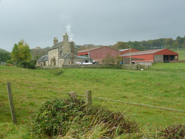
Entry Name: Ainville
Listing Name: Ainville Farm-House
Listing Date: 22 January 1971
Category: B
Source: Historic Scotland
Source ID: 339222
Historic Scotland Designation Reference: LB7363
Building Class: Cultural
ID on this website: 200339222
Location: Kirknewton
County: West Lothian
Electoral Ward: Pentland Hills
Parish: Kirknewton
Traditional County: Midlothian
Tagged with: Building
Later 18th cent. Georgian. 2 1/2 storeys; 3 bays. Thinly
rendered. Skew-gabled. Slated roof. Mutules. Round-headed
gable windows. Cornice on modilions over door. 1-storey
piended wings.
External links are from the relevant listing authority and, where applicable, Wikidata. Wikidata IDs may be related buildings as well as this specific building. If you want to add or update a link, you will need to do so by editing the Wikidata entry.


Other nearby listed buildings
