Approximate Location Map
Large Map »
Latitude: 55.8976 / 55°53'51"N
Longitude: -3.4552 / 3°27'18"W
OS Eastings: 309099
OS Northings: 668123
OS Grid: NT090681
Mapcode National: GBR 4097.RQ
Mapcode Global: WH5RQ.W1T4
Plus Code: 9C7RVGXV+2W
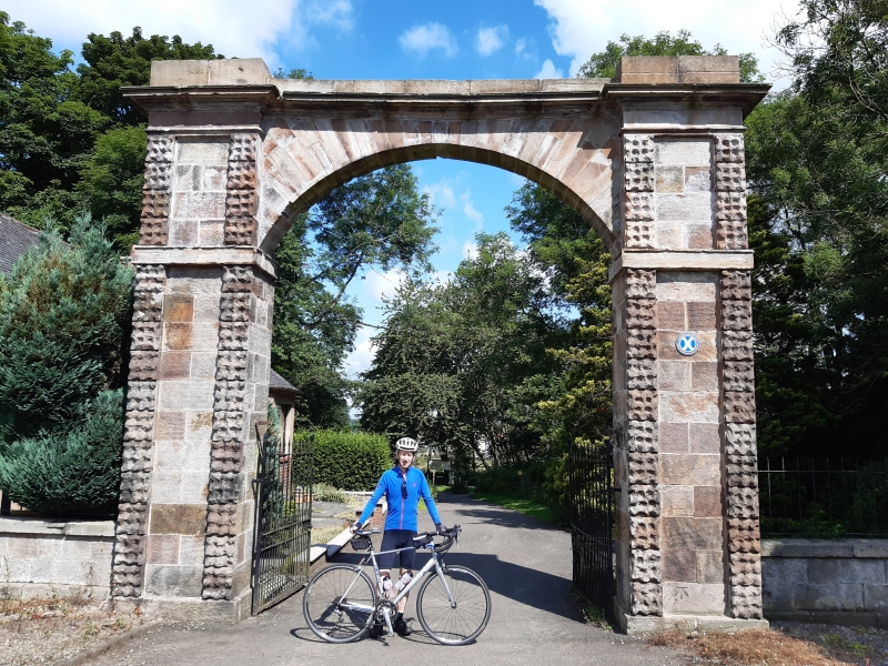
Entry Name: South Gate, Almondell Park
Listing Name: South Gate-Way Almondell Park
Listing Date: 25 June 1980
Category: B
Source: Historic Scotland
Source ID: 339228
Historic Scotland Designation Reference: LB7369
Building Class: Cultural
ID on this website: 200339228
Location: Kirknewton
County: West Lothian
Electoral Ward: East Livingston and East Calder
Parish: Kirknewton
Traditional County: Midlothian
Tagged with: Gate
Earlier 19th cent. Segmental arch. Dressed voussoirs.
Hammer-dressed piers. Flanked by quadrant die-walls.
At entrance to avenue to Almondell House (demolished).
West Lothian. Lodge has been much altered.
External links are from the relevant listing authority and, where applicable, Wikidata. Wikidata IDs may be related buildings as well as this specific building. If you want to add or update a link, you will need to do so by editing the Wikidata entry.


Other nearby listed buildings
