Approximate Location Map
Large Map »
Latitude: 55.9001 / 55°54'0"N
Longitude: -3.463 / 3°27'46"W
OS Eastings: 308618
OS Northings: 668410
OS Grid: NT086684
Mapcode National: GBR 4086.2T
Mapcode Global: WH5RJ.SY4S
Plus Code: 9C7RWG2P+2Q
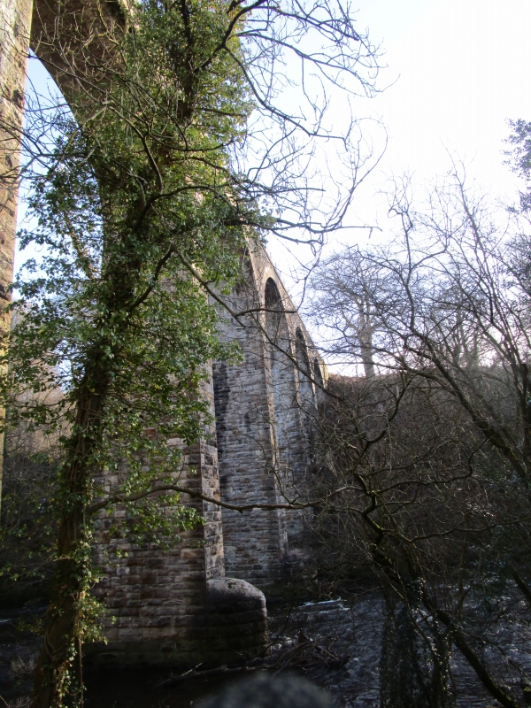
Entry Name: Camps Viaduct
Listing Name: Mineral Railway Viaduct, River Almond
Listing Date: 22 January 1971
Category: B
Source: Historic Scotland
Source ID: 339231
Historic Scotland Designation Reference: LB7372
Building Class: Cultural
Also known as: Almondell Viaduct
ID on this website: 200339231
Location: Kirknewton
County: West Lothian
Electoral Ward: East Livingston and East Calder
Parish: Kirknewton
Traditional County: Midlothian
Tagged with: Viaduct Railway viaduct
1885. 9 high segmental brick arches on rock-faced snecked
rubble piers. Rubble parapet with iron railing.
Rounded cut-waters.
Partly in Mid Calder.
Built for branch mineral railway to camps.
External links are from the relevant listing authority and, where applicable, Wikidata. Wikidata IDs may be related buildings as well as this specific building. If you want to add or update a link, you will need to do so by editing the Wikidata entry.


Other nearby listed buildings
