Approximate Location Map
Large Map »
Latitude: 55.33 / 55°19'48"N
Longitude: -4.7778 / 4°46'40"W
OS Eastings: 223884
OS Northings: 607511
OS Grid: NS238075
Mapcode National: GBR 43.6B4X
Mapcode Global: WH2QD.L918
Plus Code: 9C7Q86JC+2V
Entry Name: Old Parish Church And Graveyard, Kirkoswald
Listing Name: Ruin of Old Church and Graveyard. Kirkoswald
Listing Date: 15 February 1977
Category: B
Source: Historic Scotland
Source ID: 339527
Historic Scotland Designation Reference: LB7584
Building Class: Cultural
ID on this website: 200339527
Location: Kirkoswald
County: South Ayrshire
Electoral Ward: Girvan and South Carrick
Parish: Kirkoswald
Traditional County: Ayrshire
Tagged with: Church building Cemetery
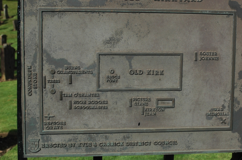
Presents an ancient appearance, but closer examination shows
that it has been modernised beyond recognition when converted
into a mausoleum - Graveyard contains graves of Tam O'
Shanter, Souter Johnnie and other associates of Robert
Burns.
External links are from the relevant listing authority and, where applicable, Wikidata. Wikidata IDs may be related buildings as well as this specific building. If you want to add or update a link, you will need to do so by editing the Wikidata entry.


Other nearby listed buildings
