Approximate Location Map
Large Map »
Latitude: 58.1838 / 58°11'1"N
Longitude: -3.5013 / 3°30'4"W
OS Eastings: 311814
OS Northings: 922640
OS Grid: ND118226
Mapcode National: GBR K7Q3.2TR
Mapcode Global: WH5DH.5KZM
Plus Code: 9CCR5FMX+GF
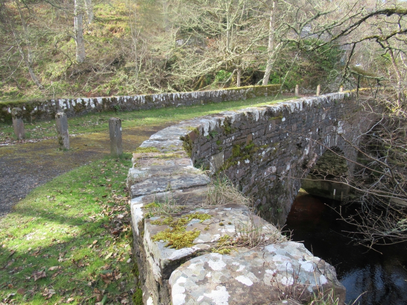
Entry Name: Bridge, Berriedale
Listing Name: Berriedale, 2 Bridges over Berriedale and Langwell Waters
Listing Date: 28 November 1984
Category: C
Source: Historic Scotland
Source ID: 340000
Historic Scotland Designation Reference: LB7968
Building Class: Cultural
ID on this website: 200340000
Location: Latheron
County: Highland
Electoral Ward: Wick and East Caithness
Parish: Latheron
Traditional County: Caithness
Tagged with: Road bridge
Thomas Telford, circa 1815. Pair single span rubble bridges
sited close together at confluence of two rivers. Each with
dressed rubble arch wing and low dressed rubble parapet.
Splayed approaches.
Now by-passed.
External links are from the relevant listing authority and, where applicable, Wikidata. Wikidata IDs may be related buildings as well as this specific building. If you want to add or update a link, you will need to do so by editing the Wikidata entry.


Other nearby listed buildings
