Approximate Location Map
Large Map »
Latitude: 56.1641 / 56°9'50"N
Longitude: -4.0609 / 4°3'39"W
OS Eastings: 272115
OS Northings: 698742
OS Grid: NS721987
Mapcode National: GBR 16.HRN0
Mapcode Global: WH4NY.LBFB
Plus Code: 9C8Q5W7Q+MJ
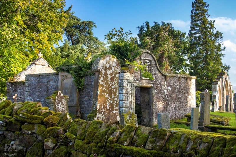
Entry Name: St Lolan's Church And Burial Ground (Kincardine Graveyard)
Listing Name: Kincardine Graveyard
Listing Date: 5 October 1971
Category: B
Source: Historic Scotland
Source ID: 340546
Historic Scotland Designation Reference: LB8410
Building Class: Cultural
ID on this website: 200340546
Location: Kincardine (Stirling)
County: Stirling
Electoral Ward: Trossachs and Teith
Parish: Kincardine (Stirling)
Traditional County: Perthshire
Tagged with: Church building Cemetery Architectural structure
Site of former parish church. Contains two burial enclosures, both with fine armorial panels, that on the west of 1699 and that on the east of
1686, Home Drummond enclosure with 3 large gothic arches containing red granite panels 1894: fragments from Dunblane Cathedral incorporated.
Stones from 17th cent. onwards.
External links are from the relevant listing authority and, where applicable, Wikidata. Wikidata IDs may be related buildings as well as this specific building. If you want to add or update a link, you will need to do so by editing the Wikidata entry.


Other nearby listed buildings
