Approximate Location Map
Large Map »
Latitude: 56.2303 / 56°13'48"N
Longitude: -2.8435 / 2°50'36"W
OS Eastings: 347801
OS Northings: 704510
OS Grid: NO478045
Mapcode National: GBR 2P.CH3N
Mapcode Global: WH7SK.9N5N
Plus Code: 9C8V65J4+4H
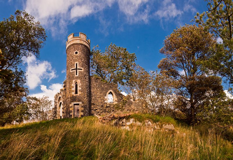
Entry Name: Folly, Balcarres House
Listing Name: Balcarres House - Folly on Balcarres Craig
Listing Date: 1 February 1972
Category: B
Source: Historic Scotland
Source ID: 340806
Historic Scotland Designation Reference: LB8630
Building Class: Cultural
ID on this website: 200340806
Location: Kilconquhar
County: Fife
Electoral Ward: East Neuk and Landward
Parish: Kilconquhar
Traditional County: Fife
Tagged with: Folly
Circa 1820. Gothick, circular crenellated whin rubble tower of 4 stages flanked by "ruined" curtain walls with gothic windows.
External links are from the relevant listing authority and, where applicable, Wikidata. Wikidata IDs may be related buildings as well as this specific building. If you want to add or update a link, you will need to do so by editing the Wikidata entry.


Other nearby listed buildings
