Approximate Location Map
Large Map »
Latitude: 56.2922 / 56°17'31"N
Longitude: -2.6466 / 2°38'47"W
OS Eastings: 360073
OS Northings: 711268
OS Grid: NO600112
Mapcode National: GBR 2X.7KBR
Mapcode Global: WH8TL.93YP
Plus Code: 9C8V79R3+V9
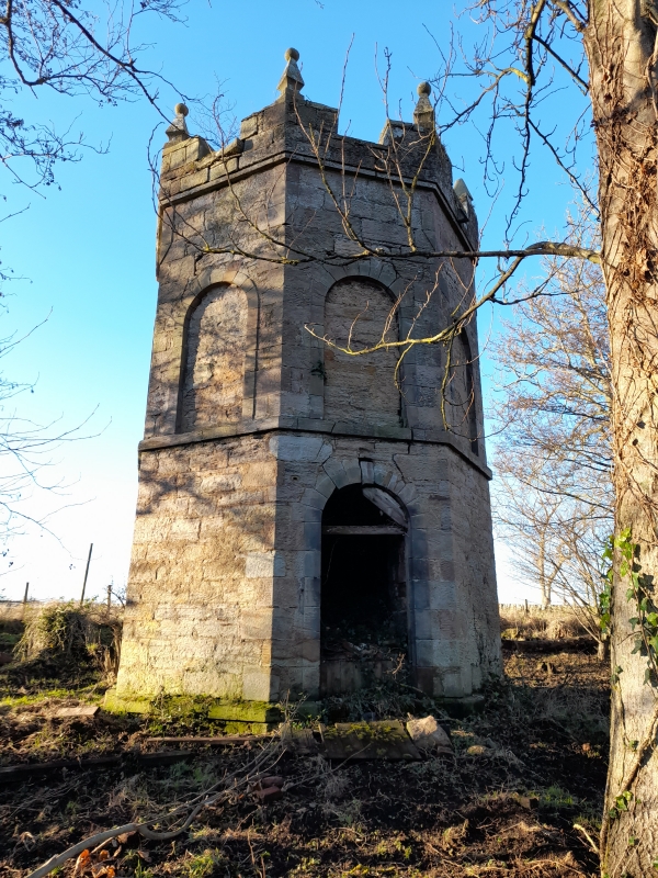
Entry Name: Canbo Dovecot
Listing Name: Cambo Dovecot
Listing Date: 23 November 1971
Category: B
Source: Historic Scotland
Source ID: 341004
Historic Scotland Designation Reference: LB8793
Building Class: Cultural
ID on this website: 200341004
Location: Kingsbarns
County: Fife
Electoral Ward: East Neuk and Landward
Parish: Kingsbarns
Traditional County: Fife
Tagged with: Dovecote
Late 18th century. Octagonal, rubble-built, arched and keyblocked doorway, arched recesses at upper level. Crenellated parapet with finials, slated roof.
External links are from the relevant listing authority and, where applicable, Wikidata. Wikidata IDs may be related buildings as well as this specific building. If you want to add or update a link, you will need to do so by editing the Wikidata entry.


Other nearby listed buildings
