Approximate Location Map
Large Map »
Latitude: 56.2536 / 56°15'12"N
Longitude: -3.2091 / 3°12'32"W
OS Eastings: 325185
OS Northings: 707444
OS Grid: NO251074
Mapcode National: GBR 27.9YVZ
Mapcode Global: WH6R7.P22R
Plus Code: 9C8R7Q3R+C9
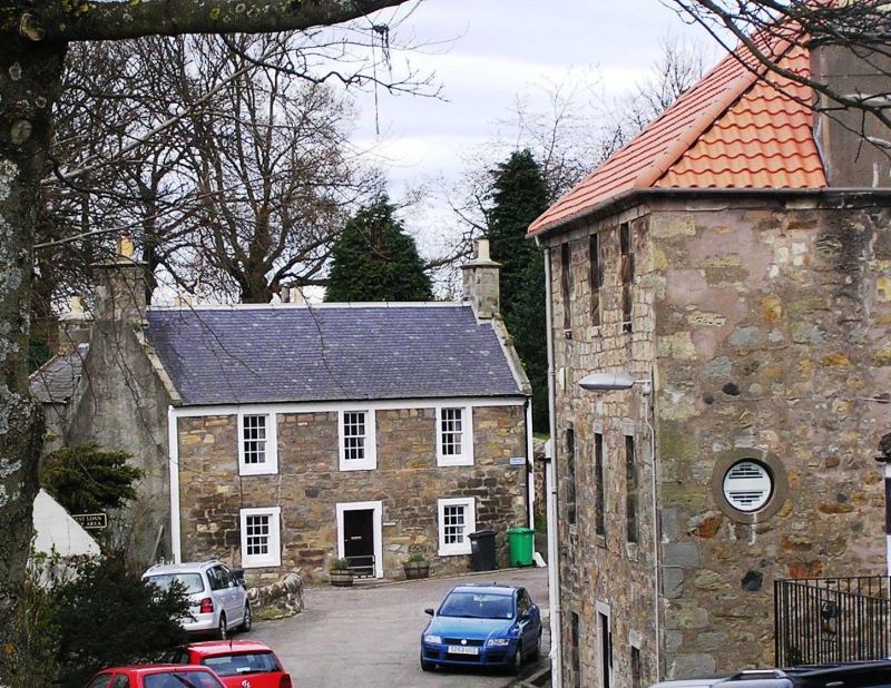
Entry Name: Bridgend, Balmblae, Falkland
Listing Name: Bridgend, East End, Balmblae, Falkland
Listing Date: 1 February 1972
Category: B
Source: Historic Scotland
Source ID: 341015
Historic Scotland Designation Reference: LB8804
Building Class: Cultural
ID on this website: 200341015
Location: Falkland
County: Fife
Electoral Ward: Howe of Fife and Tay Coast
Parish: Falkland
Traditional County: Fife
Tagged with: Architectural structure
18th century, former public house, 2-storey 3-window rubble-built with margins and moulded eaves course, gables harled; slated, crowstepped at back.
External links are from the relevant listing authority and, where applicable, Wikidata. Wikidata IDs may be related buildings as well as this specific building. If you want to add or update a link, you will need to do so by editing the Wikidata entry.


Other nearby listed buildings
