Approximate Location Map
Large Map »
Latitude: 57.2207 / 57°13'14"N
Longitude: -3.2691 / 3°16'8"W
OS Eastings: 323459
OS Northings: 815153
OS Grid: NJ234151
Mapcode National: GBR L99M.TCZ
Mapcode Global: WH6LC.RRGX
Plus Code: 9C9R6PCJ+79
Entry Name: Well Of The Lecht
Listing Name: Lecht, Well of the Lecht
Listing Date: 22 February 1972
Category: B
Source: Historic Scotland
Source ID: 341154
Historic Scotland Designation Reference: LB8925
Building Class: Cultural
ID on this website: 200341154
Location: Kirkmichael (Moray)
County: Moray
Electoral Ward: Speyside Glenlivet
Parish: Kirkmichael (Moray)
Traditional County: Banffshire
Tagged with: Architectural structure Monument
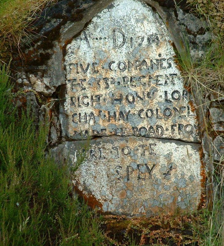
Plaque dated 1754 inserted in later masonry plinth over small
freshwater spring.
Scheduled Monument.
Plaque inscribed 'AD 1754 Five companies 33rd Regiment Right
Hon Lord Chas Hay made the road from here to the Spey'.
Road links Deeside with Speyside over Lecht pass.
External links are from the relevant listing authority and, where applicable, Wikidata. Wikidata IDs may be related buildings as well as this specific building. If you want to add or update a link, you will need to do so by editing the Wikidata entry.


