Approximate Location Map
Large Map »
Latitude: 56.453 / 56°27'10"N
Longitude: -2.8724 / 2°52'20"W
OS Eastings: 346323
OS Northings: 729325
OS Grid: NO463293
Mapcode National: GBR VN.48S3
Mapcode Global: WH7RK.V2CC
Plus Code: 9C8VF43H+62
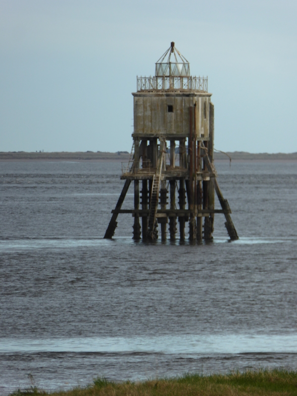
Entry Name: Pile Lighthouse, Firth Of Tay, Tayport
Listing Name: Pile Lighthouse
Listing Date: 8 August 1973
Category: B
Source: Historic Scotland
Source ID: 341256
Historic Scotland Designation Reference: LB9009
Building Class: Cultural
Also known as: Tayport, Firth Of Tay, Pile Lighthouse
ID on this website: 200341256
Location: Ferry Port On Craig
County: Fife
Electoral Ward: Tay Bridgehead
Parish: Ferry Port On Craig
Tagged with: Lighthouse
Timber stilts with superstructure 1848 probably by James Leslie.
Navigational in use as such.
External links are from the relevant listing authority and, where applicable, Wikidata. Wikidata IDs may be related buildings as well as this specific building. If you want to add or update a link, you will need to do so by editing the Wikidata entry.


Other nearby listed buildings
