Approximate Location Map
Large Map »
Latitude: 57.2592 / 57°15'33"N
Longitude: -2.6334 / 2°38'0"W
OS Eastings: 361887
OS Northings: 818906
OS Grid: NJ618189
Mapcode National: GBR M9VJ.QBG
Mapcode Global: WH8NR.JS6W
Plus Code: 9C9V7958+MJ
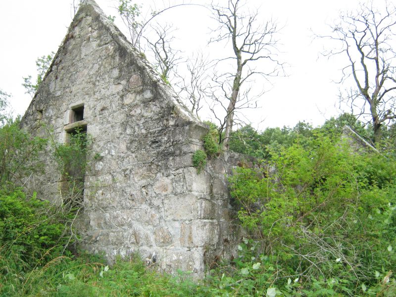
Entry Name: Old Church And Burial-Ground, Keig
Listing Name: Old Church of Keig and Churchyard
Listing Date: 16 April 1971
Category: B
Source: Historic Scotland
Source ID: 341308
Historic Scotland Designation Reference: LB9055
Building Class: Cultural
ID on this website: 200341308
Location: Keig
County: Aberdeenshire
Electoral Ward: Huntly, Strathbogie and Howe of Alford
Parish: Keig
Traditional County: Aberdeenshire
Tagged with: Church building Cemetery
17th century. Roofless rectangle rubble-built, straight skews
with wide skewputs, no bellcote; unusual W. window narrower
above transom; S. flank of 3 windows with doors between, centre
window slightly higher; small square fontbowl. Monument to James
16th Lord Forbes on E. wall 18th century stones in churchyard.
External links are from the relevant listing authority and, where applicable, Wikidata. Wikidata IDs may be related buildings as well as this specific building. If you want to add or update a link, you will need to do so by editing the Wikidata entry.


Other nearby listed buildings
