Approximate Location Map
Large Map »
Latitude: 55.0568 / 55°3'24"N
Longitude: -3.3135 / 3°18'48"W
OS Eastings: 316193
OS Northings: 574380
OS Grid: NY161743
Mapcode National: GBR 599Z.F2
Mapcode Global: WH6Y0.25D6
Plus Code: 9C7R3M4P+PH
Entry Name: Shortrigg
Listing Name: Shortrig Farmhouse
Listing Date: 4 October 1988
Category: C
Source: Historic Scotland
Source ID: 342433
Historic Scotland Designation Reference: LB10040
Building Class: Cultural
ID on this website: 200342433
Location: Hoddom
County: Dumfries and Galloway
Electoral Ward: Annandale North
Parish: Hoddom
Traditional County: Dumfriesshire
Tagged with: Farmhouse
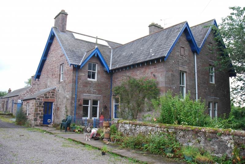
Late 19th century farmhouse; asymmetrical; 2 storeys, with
gabled bays, single or bipartite windows with plate-glass or
2-pane sashes; projecting eaves; coped stacks. Built mostly
of squared rubble with ashlar dressings, earlier fabric
incorporated to N at ground level. Roofs covered with
graded slates.
External links are from the relevant listing authority and, where applicable, Wikidata. Wikidata IDs may be related buildings as well as this specific building. If you want to add or update a link, you will need to do so by editing the Wikidata entry.


Other nearby listed buildings
