Approximate Location Map
Large Map »
Latitude: 56.0581 / 56°3'29"N
Longitude: -4.3719 / 4°22'18"W
OS Eastings: 252403
OS Northings: 687569
OS Grid: NS524875
Mapcode National: GBR 0V.Q7TX
Mapcode Global: WH3N1.TZBM
Plus Code: 9C8Q3J5H+77
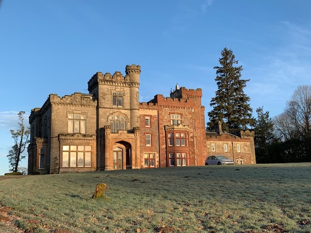
Entry Name: Carbeth House, Killearn
Listing Name: Carbeth House
Listing Date: 5 September 1973
Category: B
Source: Historic Scotland
Source ID: 342846
Historic Scotland Designation Reference: LB10395
Building Class: Cultural
ID on this website: 200342846
Location: Killearn
County: Stirling
Electoral Ward: Forth and Endrick
Parish: Killearn
Traditional County: Stirlingshire
Tagged with: Country house
C17th C19th enlargement in castle style. Dated 1879 over
porch. Porte cochere. Large and impressive, but brown painted
casements against stone.
External links are from the relevant listing authority and, where applicable, Wikidata. Wikidata IDs may be related buildings as well as this specific building. If you want to add or update a link, you will need to do so by editing the Wikidata entry.


Other nearby listed buildings
