Approximate Location Map
Large Map »
Latitude: 56.0193 / 56°1'9"N
Longitude: -3.8377 / 3°50'15"W
OS Eastings: 285548
OS Northings: 682236
OS Grid: NS855822
Mapcode National: GBR 1H.SMV9
Mapcode Global: WH5QS.0YTW
Plus Code: 9C8R2596+PW
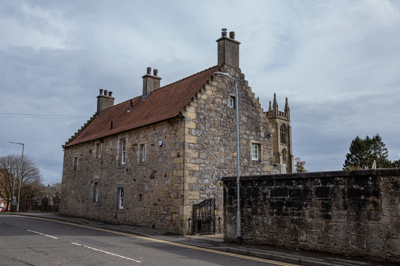
Entry Name: Old Manse, Denny Road, Larbert
Listing Name: Old Manse
Listing Date: 25 October 1972
Category: B
Source: Historic Scotland
Source ID: 342986
Historic Scotland Designation Reference: LB10516
Building Class: Cultural
ID on this website: 200342986
Location: Larbert
County: Falkirk
Electoral Ward: Bonnybridge and Larbert
Parish: Larbert
Traditional County: Stirlingshire
Tagged with: Manse
Dated 1635. Restored 1955.
Rectangular plan. Modern pantile roof with crowstepping 2
storey random stone.
External links are from the relevant listing authority and, where applicable, Wikidata. Wikidata IDs may be related buildings as well as this specific building. If you want to add or update a link, you will need to do so by editing the Wikidata entry.


Other nearby listed buildings
