Approximate Location Map
Large Map »
Latitude: 56.0164 / 56°0'59"N
Longitude: -3.832 / 3°49'55"W
OS Eastings: 285890
OS Northings: 681901
OS Grid: NS858819
Mapcode National: GBR 1H.SWM2
Mapcode Global: WH5QZ.31HL
Plus Code: 9C8R2589+H5
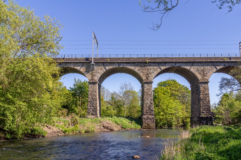
Entry Name: Larbert Viaduct
Listing Name: Larbert Viaduct
Listing Date: 23 April 1979
Category: B
Source: Historic Scotland
Source ID: 342987
Historic Scotland Designation Reference: LB10517
Building Class: Cultural
ID on this website: 200342987
Location: Larbert
County: Falkirk
Electoral Ward: Bonnybridge and Larbert
Parish: Larbert
Traditional County: Stirlingshire
Tagged with: Viaduct Railway viaduct
Early C19th 15 arches stone carries the main railway over the
Carron Valley.
Still in use but narrow arches mean traffic lights for
roadway below.
Scheduled Monument.
External links are from the relevant listing authority and, where applicable, Wikidata. Wikidata IDs may be related buildings as well as this specific building. If you want to add or update a link, you will need to do so by editing the Wikidata entry.


Other nearby listed buildings
